Kansas Department of Transportation
 The US state of Kansas DOT just rolled out a huge improvement to their 511 site. The site has a built in dashboard around a Microsoft Virtual Earth map interface for super easy access to information pertaining to roadways.
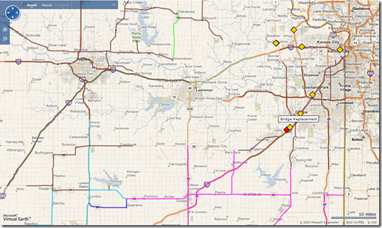
Specifically, the application highlights activities that are planned (yellow, good to know for the future), active (orange, happening right now) or closed (red, to show you your tax dollars were put to good use). With the dashboard interface, you can simply check a box and show all activities or just ones with the status that interest you.
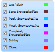
 Now, here’s the killer part – they’ve drawn color coded vector information on the map to indicate the condition of the roads! So, anywhere on any color coded route you can hover over the road with your mouse and see the road name, the condition status and the last time the data was updated. “Why are all of the roads in and around Topeka, KS brown?” I asked myself. “Ah, because of snow packed ice in spots.” The map above highlights just how discreet the information is too – there were all 7 types of conditions happening when I took my screenshot. And, read these conditions – Wet/Slush, Spots Snowpacked/Ice, Partly Snowpacked/Ice, Mostly Snowpacked/Ice, Completely Snowpacked/Ice, Drifting (WTH is drifting?), Closed….lots of white knuckles in Kansas, gees. I did find that some of the colors on the map are tough to distinguish, but if you’ve passed your driver’s license test you should be able to tell them apart – colorblindness doesn’t help though.
CP
