Geospatial Map Annotations in the Spatial Wiki
 We in the GIS and LBS world have long wondered how it would be possible to create such a mapping engine that would render the most accurate, up to date maps available with roads and points of interest, geographic boundaries, etc., etc. Let’s put geopolitical issues aside (or not) and in our heads we’ve all considered this open map system which allows users to contribute to a wiki of sorts to create maps of their respective areas where there are experts and have the data readily available. The concept is coming closer to reality with IDV’s Spatial Wiki which allows you to contribute to the creation of what may become a serious repository of location information inclusive of all the data we the world need to improve the scale and accuracy of mapping out the world in order to use it as the canvas in which we paint our information for data visualization. The interface for this has been challenging, but with Virtual Earth and Silverlight on the front end and IDV’s Fusion Server (a layer atop of SQL Server) in the back end it seems the time is right for just such an experiment to get us a step closer to spatial Shangri-la.
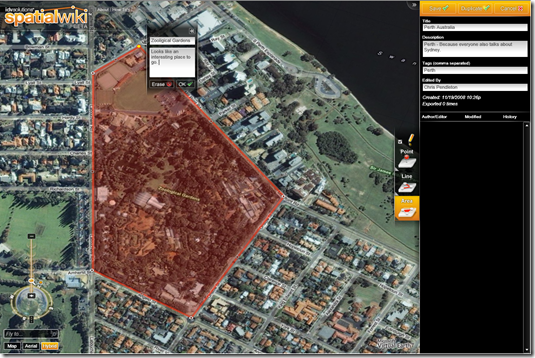
The site allows you to search through the current repository of user contributed data. You can modify data that exists today. You can restore data since the Drawings have a time dimension / source control feature added to them. Or, you could just draw your own maps to create specific regions of interest to you and save them for future reference. I created a small collection (known as a Drawing) of information over Perth, Australia. As a part of my new role I now cover Australia in helping educate users (and, yes, incenting people to license Virtual Earth) in the land of Oz, so it’s time to explore a bit.
Once I created my Drawing, it immediately showed up at the top of the drawing list filtered by most recently added (you can also sort the listings by most popular, alphabetical or preview status). I can take this data for my own selfish needs and export it to a SQL Server 2008 .SQL file or a .KML file (which can be imported into Virtual Earth or, of course, Google Earth). I could also share my Drawing by sending a link which brings users right to my Drawing. Both of these options appear in the Drawing list next to each item.
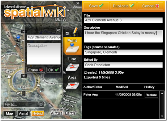
Now, what’s great is how the community can use my data. I did a search on Singapore (I now own Asia Pacific too). First off, the auto filter sorted my results to a single item, so as I was typing the list grew smaller and smaller. Love that. With the single result, I was able to then modify the Drawing by adding my own description. Now, I can either modify this Drawing by saving the information or I can duplicate it and make it my own. The ultimate shared resource for spatial information!
The Spatial Wiki is very much like the Collections feature on Live Search Maps in that you can store your collection of points, polygons and lines in a cloud and search on them. While Collections on Live Search Maps play a bigger role in the Microsoft strategy by indexing the results in Live Search, the Spatial Wiki fills a void for some really great, easy to use tools for sharing and duplicating map annotations. Now, a year from now when the wiki is good and full, what do you think IDV is going to do with all this data? That, my friends, is the million dollar question.
CP

