Texas Loves Virtual Earth
And, Virtual Earth loves Texas! Check out the Texas Department of Transportation web sites that are leveraging Microsoft Virtual Earth to better visualize their traffic flow and incident information. Check out these cities with their respective information visualization.
El Paso launched a few months ago with a simple checkbox format. Check the box for turning on information (1) along certain routes - Interstate Highway 10, US Freeway 54, the 375 Loop, Mesa St, Montana Ave, or all side streets where data is available; (2) live web cameras; (3) Digital Messaging Signs (which I LOVE, btw - being able to see what it is displayed on the road signs from the web - so cool!); (4) incidents; and (5) closures. A simple interface for some really great data.
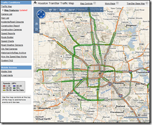 Houston has also been live for a while and is robust with links for data and a drop down for map controls. If you click the links down the left, you'll be taken to another web page; however, if you want to see the data integrated with the map you simply need to pull down the "Map Controls" arrow at the top for checking off flow data, incidents, lane closures, cameras, and message signs. You can also zoom in and out of the map there. Houston also provides additional maps for different parts of the greater Houston area under the "More Maps" arrow above the map.
Amarillo just launched with Virtual Earth. They've started simple with cameras and sign information.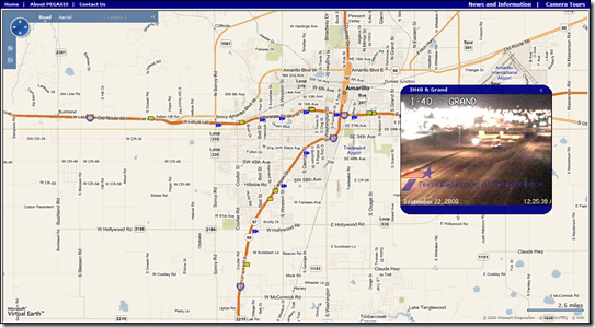
Laredo just launched with Virtual Earth with live camera feeds. 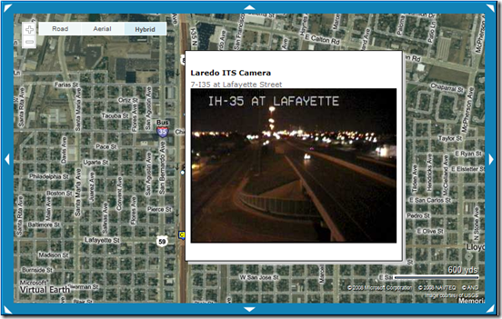
Lubbock just launched with Virtual Earth pinning live camera feeds to their Virtual Earth map.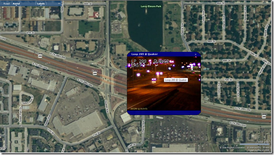
And, Wichita Falls is also live with Virtual Earth showing live traffic camera feeds and those wonderful signs for their freeways.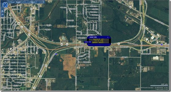
Texas has always held a special place in my heart. Well, Texas is onboard. Who's next? And, by the way, seriously, Don't Mess With Texas. After all, they are the ONLY state with Federal permission to fly their flag above the United States flag.
CP