Hurricane Gustav Coverage with Virtual Earth
I found a couple good sites using Virtual Earth to visualize information about Hurricane Gustav (in addition to the Texas Natural Resources Information System Launches Emergency Resource Site). See below.
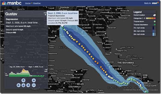
MSNBC - Shows the path, points along the path with additional information, timeline intensity, plus additional storms from the pull down.
The Timoney Group (GulfImpact.com) - Shows the impact of Hurricane Gustav and the effect of US energy supplies in the Gulf of Mexico. See how many barrels of oil a day the US stands to lose, how many active platforms, effects on natural gas output, etc.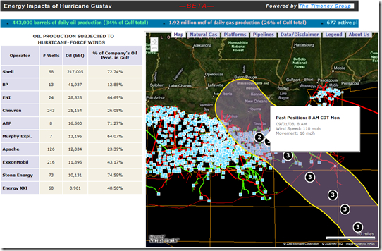
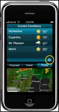 Weather Central (MyWeather Mobile) - If you're on your iPhone, you can download Weather Central's MyWeather Mobile Application. See the most current radar images of storm cells animating in gorgeous full color. Track storms and keep tabs on active weather for the locations that matter to you. Pinpoint your exact location using the iPhone’s location-aware technology and zoom right down to the street level. This is the feature that you have been waiting for! We are the only weather application that offers looping radar!
CNN - Virtual Earth maps featuring Bird's Eye imagery can be seen on the network broadcasts about Hurricane Gustav.
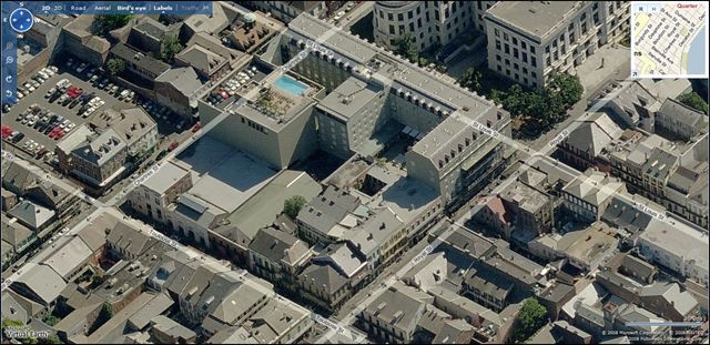
Live Search Maps - For those of you in NOLA (or other affected areas), you can always leverage Live Search Maps for high resolution Bird's Eye imagery of the New Orleans area to show your insurance adjuster the before and after photos. People actually did this post-Katrina and it worked!
CP