Purchase Standalone Microsoft Virtual Earth Photography

If you've ever had the need to acquire Virtual Earth aerial photography for uses outside of the Virtual Earth platform, your day has come. Starting today you can license Virtual Earth UltraCam (proprietary) aerial photography without having to license the Virtual Earth platform. This is great for offline use, wrapping your own client or creating an interface that allows for deeper zooming than the VE platform does today. You can purchase the photography through 2 vendors - Mapmart and i-Cubed. Here's the official announcement...
We’re pleased to announce that VE UltraCam orthos can now be licensed for offline use!
We’ve recently signed two resellers to offer our hi-resolution UltraCam imagery for offline applications.
These groundbreaking deals are the first milestone in VE’s monetization of MS-owned geospatial products.
Why are We Doing This?
VE’s hi-resolution UltraCam ortho imagery is prized for GIS, urban planning, engineering and other applications that are often performed in an offline desktop environment, yet our existing VE offerings prohibit any offline use of our data. By offering our data in an offline mode, we complement our online VE web service offerings, increase VE brand awareness worldwide, and generate revenues.
How are We Doing This?
Our resellers will host the data and provide sales, marketing and fulfillment services. We selected i-cubed, LLC and Mapmart.com as our resellers. Both are top-notch companies with proven leadership in the geodata markets, and we’re excited to have them lead our channel sales.
· i-cubed, LLC is a top-tier provider of imagery, data distribution software, and image processing services to governments and commercial entities worldwide. As the exclusive data provider for ESRI’s ArcGIS users who want to use data locally, they will offer VE’s UltraCam imagery through the ESRI platform (Beta) and through a standalone web site they’ll launch next week.
· MapMart.com is a high volume geodata provider with strong experience in the "prosumer" market. They just launched VE’s UltraCam data on their web site last week.
What’s Available and Who Needs it?
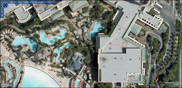
Currently we have over 200 cities of mosaicked color airborne imagery collected at 6”nominal resolution, averaging less than two years old. The 6” spatial resolution rivals any large-scale commercial source today, and our newest processing techniques produce orthomosaics with almost no building lean in the image- invaluable for unobstructed views into areas with tall buildings, etc. As Microsoft acquires and processes imagery for more cities around the world, the archive is expected to grow substantially.
This imagery will be invaluable for urban planners, GIS analysts, and the prosumer geospatial market. We expect municipalities, engineering firms, emergency response agencies, and utilities to be core customers.
Well, that's just groovy now isn't it?
CP