Announcing the Microsoft Virtual Earth ASP .Net Server Control
Don't like JavaScript? You want your managed code with the new wave of AJAX maps? Well, the long awaited Virtual Earth ASP .Net Server Control is now available for download as a part of the Windows Live Tools for Microsoft Visual Studio.
Here are some of the features and benefits of the control:
![clip_image002[7]](https://msdntnarchive.blob.core.windows.net/media/TNBlogsFS/BlogFileStorage/blogs_msdn/virtualearth/WindowsLiveWriter/AnnouncingtheMicrosoftV.NetServerControl_12F62/clip_image002%5B7%5D.jpg) Toolbox – The Virtual Earth Map control is available in your Visual Studio toolbox with the rest of your controls. Just add it to your library and it will be there for you when you need a map.
Toolbox – The Virtual Earth Map control is available in your Visual Studio toolbox with the rest of your controls. Just add it to your library and it will be there for you when you need a map.
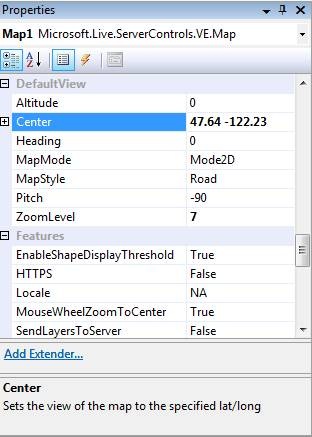
Drag and Drop – Like any control in Visual Studio, you can drag and drop the control from toolbox onto your application, set the respective properties you want and off you go .
Server Side Events – You can now use server side events for navigating the map, geocoding and directions. Plus, you can still use client side events to capture user interaction in the map control.
Display and Control – You can control how the map displays in your application with standard functions like MapMode(2D/3D), MapStyle(Road/Aerial), displaying dashboard and setting its size, setting the zoom levels, zooming in/out, panning, etc.
Adding Shapes – You can add shapes to the map from ASP.NET using the methods provided. You can query different shapes/layers in the map, add and delete them.
Using Directions – You can get the routes and itineraries between multiple points using the directions method. You can specify different routing options like distance unit, route type and route color. Once the direction information is received, the map control raises events where you can process/render the returned information in way that fits your application needs.
 Local Search – Search for local listings via the ASP .Net Control - the same ones that appear on Live Search Maps.
Working with Bird’s Eye - The map control has support for bird’s eye view similar to JavaScript control.
Traffic – You can get traffic information and display on the map control. For this, you'll need to have an account with Virtual Earth Platform and enable the GetToken() methods for tracking purposes. You can then use this client token to display the traffic of the location you are interested in.
We just keep expanding the offerings and ways in which you can interface with Microsoft Virtual Earth. This is just one more for you ASP .Net Developers to take full advantage of the power of Virtual Earth maps without having to worry about learning JavaScript or setting alert()s throughout your code to find out WTH is wrong with your application. If I see "Syntax Error" one more time I may have to throw my computer out the window.
CP