Trips and Pics with Microsoft Virtual Earth
James Oyang, recently granted me a copy of Pharos Trips and Pics with GPS. I've been a longstanding user of the Pharos GPS with Streets and Trips and MapPoint, but with the continued growth of online photo-sharing and using maps as a backdrop I wanted to find something that scales a bit better. So, I took the GPS with me, installed the software and synchronized my camera clock with my computer clock. After leaving the ESRI Developer Summit, I had a meeting in Las Vegas. It's a 4 hour drive, so instead of spending $700 on a ticket to Vegas I opted for the drive. I turned on my Pharos GPS and started taking pictures.
It was a brutal drive, let me tell you. I've made the drive from LA and San Diego to Las Vegas a few times, but coming from Palm Springs took me down roads that made me realize that the hills DO have eyes! Here's a sample of some of the entertaining shots along the way.
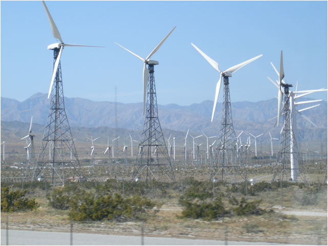
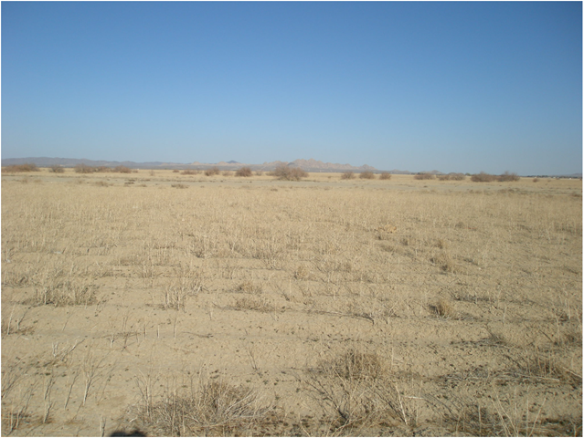
Okay, the windmills are pretty sick (left), but the rest are fairly tame (like the pic on the right). I really tried to find some interesting things, but really it was hard. Anyway, here's the new interface for Trips and Pics. I altered the skin to white because I felt like it.

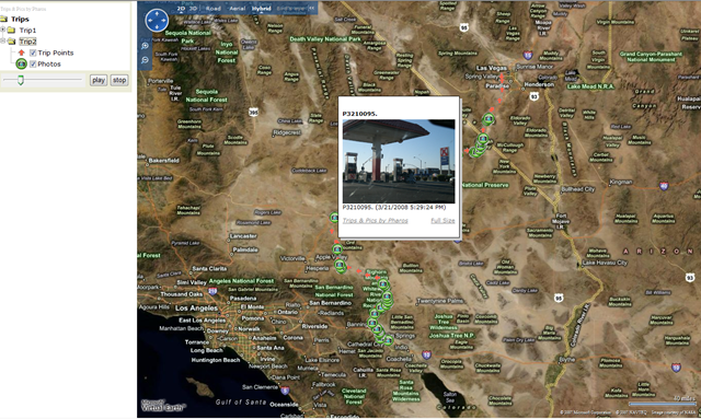
Okay, so, I have the data on my GPS, I have a bunch of random pictures and I have Google Earth installed - Virtual Earth runs in the browser so no installation is required. Select "Read Log File" and go to where you dropped your log file from the GPS. If the data is still on the GPS, you can select "Read GPS" to pull the data off. If you have pictures, select "Process Trips & Pics" and you'll get a dialogue box prompting you to select your directory of images. Then select "Virtual Earth." You can select Google Earth, but I found the user experience in Google Earth to be somewhat confusing. For example, every time I published a trip it would use the same file and overwrite - it would create a new one. So, I found myself swimming through lists of KMLs to find the trip I just published not to mention all of the other distracting KMLs Google Earth ships with. The Virtual Earth interface was MUCH cleaner. Yes, I'm biased, but seriously try it out. I provided my feedback to James, don't worry.
Once I had the settings right I clicked "Launch." It processed the data and launched a web page featuring my trips and pics on Virtual Earth. Because Virtual Earth is a web based API, the menu was completely customized for just my trips. This made it super easy to view my collection of photos. Plus, I could just let the player run and circulate through my photos.
There are a few bugs which I reported to James and provided some fixes. Mainly, Virtual Earth 3D doesn't work well (the Pharos icons don't show, nor do the pictures). And, there are some scripting errors with the timer which cause some of the pictures (for colliding icons) to not stay up for the allotted time you specify.
I had my GPS set to record a point every 5 minutes (since it was a long trip and I wanted to conserve battery). My output placed directional arrows onto the map which contain date/time information, degree information and miles per hour (YIKES!). Also, camera icons were placed onto the map to show where I had taken pictures see below.
It was super easy! I did in like 5 minutes. Now, just grab the result files and folders (which you can specify where they end up in the options) and push them up to your web site to share with your friends. And, it comes as a package with the GPS which records data right on the device. Microsoft has their own photo geo-tagging tool - Microsoft Pro Photo Tools, which has a VERY SLICK interface but there's no way to publish the data. Perhaps the best of both worlds is in order.
CP