Virtual Earth Appliance
Public sector? Firewall constraints? Can't access Virtual Earth over the Internet and you need a server based product for your mapping needs? Do you love Virtual Earth and all it's glory, but can't use it because of your network constraints? Wow, I sound like a used car salesman. Well, The Virtual Earth Appliance should take care of you.
The Vexcel team has been working on this for some time and did a soft announcement a couple weeks ago. We've piloted with some customers and are now ready to go big. If you want one or just want more information send mail to maplic@microsoft.com. Pricing includes hardware and setup plus user based pricing. We can provide more details when you email us.
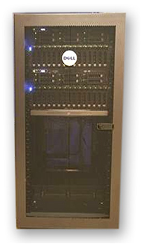
Here's a pic of the appliance:
Here's some documentation from the web site.
The Virtual Earth Appliance
Microsoft’s Virtual Earth platform is an integrated set of powerful online mapping and search services that delivers imagery, 2D & 3D geospatial data, and analysis through a web browser.
These same browser-based capabilities are now available behind a customer’s firewall, on private or classified networks, and on portable platforms.
The Virtual Earth Appliance is designed to bring all of the rich data and functionality of the Virtual Earth internet service to the offline customer.
Custom data integration with the Appliance tracks with that of Virtual Earth on the internet. With the same API and tiling structure as Virtual Earth, customers can integrate their own data or take advantage of the capabilities of Microsoft’s network of partner companies. The Virtual Earth Appliance also makes possible additional custom capabilities, including the integration of custom content.
A Platform for Geospatial Data Integration and Collaboration.
The Virtual Earth Appliance is designed to bring all of the rich data and functionality of the Virtual Earth internet service to the offline customer.
- Virtual Earth functionality and data behind a firewall, on a classified network, or on a portable platform
- Form factors to meet customers’ requirements – supports data for a city, state, region or the World
- New features and content rolled out in conjunction with Virtual Earth releases and updates
- A platform for integration and visualization of geospatial data – combine enterprise data with Virtual Earth’s rich content in 2D and 3D
- Share and collaborate across the enterprise and in the field through the integration of technologies from Microsoft and its network of partner companies
Custom Solutions to Meet Demanding Needs
As Microsoft’s geospatial subsidiary, Vexcel provides Virtual Earth Appliance support and updates, and works with customers to design the optimal solution based on enterprise size, amount of data, mobility requirements, content update frequency, and performance requirements.
CP