Google Suggests Using Microsoft MapCruncher
Being the Microsoft Virtual Earth Platform Evangelist, I'm all about getting the word out about Microsoft mapping products. There is a greater good in what I do, however and that is to get people using mapping. Something like 82% of all data in the world has a location component, so what better way to display that data than on a map? All kinds of data are creeping out of those spreadsheets and databases and getting themselves plotted onto a map. Well, I couldn't help but notice that even Google has the same idea. For the greater good, their official Google Maps API Blog suggests using Microsoft MapCruncher for creating custom maps atop of Google maps. That's just awesome. The idea behind MapCruncher is that you have maps (in .pdf or other image format) that have the need for a better interface, specifically for the web. Well, now the $50,000 you spent having a graphic artist create renderings of your new housing community, factory layout, golf course, etc. won't go to waste.
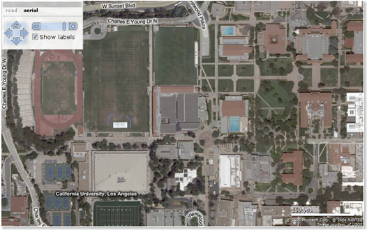
Here's a shot of the UCLA campus using a Virtual Earth aerial photo (hybrid) map:
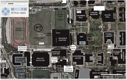
Now, here's one with the UCLA campus building information layered atop the photo using MapCruncher:
MapCruncher is a free client download that works seamlessly with Virtual Earth and the result will actually spit out an fully operational application with your maps and our maps together.
CP