Get access to free live flood warning data with the FloodAlerts API
Floods have exercised the attention of many people recently. Since December, the “FloodAlerts” warning map created by Microsoft partner Shoothill launched in 2014, has been used by the equivalent of more than 20% of the adult population of England and Wales – helping them stay up-to-date with live flood warnings issued by the Environment Agency. The map itself can be seen on the websites of the Environment Agency, BBC News, Channel 4, Sky, MSN, Facebook and on www.Shoothill.com/floodmap.
Free FloodAlerts API now available
For the first time, due to licensing restrictions being lifted by the Government, it is now possible for you to use the live flood warning data from the FloodAlerts system via a free application programming interface (API) made available by Shoothill here. In addition, for a small fee, it is also possible to directly embed the complete map within an “IFrame” on your website (again provided by Shoothill) should that be your preferred option.
This means that the citizens you serve can have access to this information live and updated in real time for your area – in exactly the same way as the Environment Agency does today – and you are free to use that data in any way you deem fit. Whichever option you choose will have no impact on your systems as all the computing resources required to run it are held via the back-end FloodAlerts system and managed by Shoothill.
How to get the API
To gain access to the free API simply go to www.shoothill.com, look for the FloodAlerts API page and sign up. Shoothill will then be in touch and supply you with all you need to use the API. Alternatively, if you would like to talk to Shoothill about embedding the map within your site, or for any general enquiry about the free API service contact Shoothill directly at flood@shoothill.com.
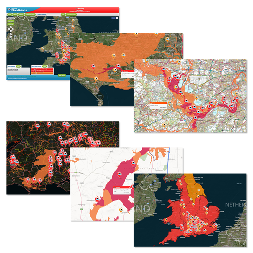
What is FloodAlerts?
If you haven’t seen the map service before, it is an interactive entity that allows you to zoom in to your own area or search for an address/postcode to see the impact that flood alerts, warnings and severe warnings issued by the Agency can have on that area. The live Environment Agency flood warning data is updated every 15 minutes and also provides detailed reports on flood warnings, so your citizens no longer have to wait for news bulletins on TV and radio but can consult this resource whenever it’s convenient, day or night.
Learn more about how Microsoft is powering tools to help people during the flood.