City of Lakewood, CO delivering richer user-experience with WPF and Silverlight applications
Here is some information on some amazing government-centric applications built by City of Lakewood, CO and hope they inspire you to deliver similar innovative solutions to your end-users on both Windows platform and all browsers.
City of Lakewood, CO has built one application “Building Permit System” with WPF (Windows Presentation Foundation; was introduced with .NET Framework 3.0 few years back), and second application “EzMaps” (available online here) with Silverlight 3 (cross-platform and cross-browser plug-in supporting all modern browsers).
I have provided learning resources on the technologies, functional summary of both applications along with the screen-shots to help you apply these technologies (WPF and/or Silverlight) in your Line of Business (LOB) applications.
Learning Resources:
WPF (Windows Presentation Foundation) and Silverlight technologies are part of the .NET Framework, and applications are built using Visual Studio 2008/2010 (tool for developers) and Expression Blend (for both designers and developers). Both tools are available as part of MSDN subscription, and here are some pointers to get started.
- Visual Studio 2010 Training Kit or Visual Studio 2008 Training Kit covers building applications with WPF (Windows Presentation Foundation).
- More information (tutorials, articles, labs, etc) on WPF and Silverlight technologies is available at https://windowsclient.net/learn/ and https://silverlight.net/getstarted.
- Expression Blend (design tool involved in customization of the UI) - Video tutorials, starter kit, tutorials and whitepapers is at https://expression.microsoft.com/en-us/cc197141.aspx
- MSDN Articles on applying MVVM patterns - WPF Development, and Silverlight Development
- Training/Information on the upcoming Silverlight 4 is also available on the Channel9 site https://channel9.msdn.com/learn/courses/Silverlight4/
1. City of Lakewood, Colorado – Building Permit System (built with WPF) – To go in production in Jul 2010
Background - The City’s building permit and inspection system was built on the Pick Basic platform in the mid-1980s, but the City has continued to maintain and enhance the system to date. With the dwindling pool of Pick programming skills in the industry, the City was faced with a system on the brink of technological obsolescence, even though it is still supported by Rocket Software from a platform perspective.
The City inspectors perform 22,000 building inspections annually and issues 8,000 to 10,000 building permits annually. Approximately $1.5 million of total revenue is generated annually for these fees and services.
Schedule & Effort - Due diligence process led to the decision of building system in-house using .Net-based implementation using Windows Presentation Foundation (WPF). Project started in July 2008, and the estimated project finish date is July 2010. Estimated effort at finish: 11,000 hours. 4 developers and 1 QA person are involved but they spend only 1/4th of their time on this project.
System Features
Feature Name |
Description |
Permit and Inspection Management |
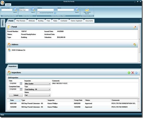
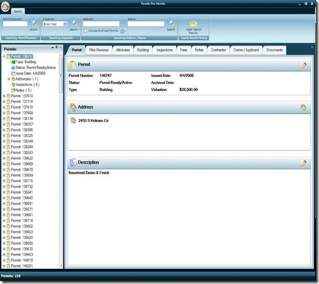
Functionality needed to research, issue, modify, and close any type of building-related permit. Also integrates functionality to create, assign, track, and close inspections throughout the construction process on the related permits. Other sub-features include building attribute data management, stop work order issuance, collateral tracking, and disconnected editing for inspectors in the field. |
Plan Review Case Management |
Ability to create, assign, track, and close plan reviews that are required during the permitting process. |
Contractor Licensing Management |
Comprehensive functionality for issuing and renewing licenses for all contractor types. |
Cash Management |
Provides the ability to take payments, manage fees, balance drawers, make adjustments, and send end-of-day batches to the GL. |
Interface other City systems |
Financial management, IVR, Address database, records management, payment card processing, authentication, and GIS. |
Provide system data access |
Develop web services channel to allow other systems to easily display permit system data. |
Future Extensions - Once the core functionality is replaced, potential extensions of the system include leveraging touch screen technology of Windows 7, web-based permit issuance, and web-based contractor licensing and renewals.
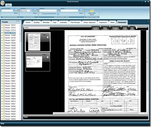
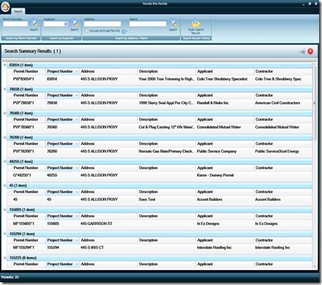
Here are some screen-shots of the Building Permit system.
2. City of Lakewood, Colorado – EzMaps 2.0 (built with Silverlight 3.0) – Deployed in production and publicly available at https://maps.lakewood.org
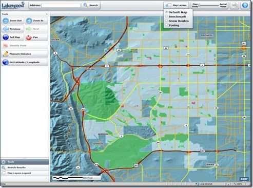
The City first released ezMaps in 2003 using ESRI’s ArcIMS product for mapping and Adobe’s Flash Player for the presentation layer. In the effort to deliver newer capabilities, City of Colorado is delivering EzMaps 2.0 using ESRI’s ArcGIS Server and Microsoft’s Silverlight to deliver a much richer and dynamic internet mapping application.
City of Lakewood, CO evaluated the products on the following criteria: strategic architectural fit, performance, market penetration, development cost, and parent-company level of investment in the technology, and made the decision to use Silverlight 3. The Silverlight 3 application provides a rich web experience and has a robust interface enabling the city to incorporate various media in the future. It allows the city to leverage our existing ESRI and Microsoft investments and create an interactive, visually enhanced web mapping application.
City is anxiously awaiting the upcoming functionality of Silverlight 4 so they can continue to enhance the ezMaps tool.
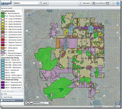
New capabilities and features available in EzMaps 2.0
- Adjustable map transparency between map view and aerial view.
- Measure distance tool provides information in feet, miles, meters, and kilometers.
- Latitude and Longitude location information.
- Drop-down map layer interaction.
- Minimize or expand the navigation pane.
- Mouse wheel zoom in and zoom out.
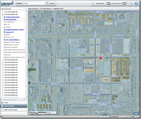
Address search results now provides
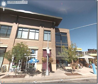
- Link to Google Street View.
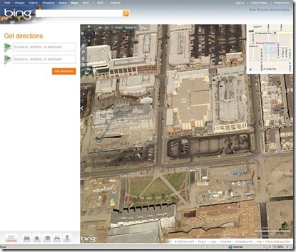
- Link to Bing Maps Bird’s Eye View.
- Floodplain information.
- Subdivision information.
- Neighborhood organization information.
Shared Services -
In addition to powering Lakewood’s Internet-based mapping, the City of Golden, Colorado also uses ezMaps for its GIS data presentation. The City of Lakewood has an agreement in place to provide the City of Golden with the ezMaps application, so two cities will be using Silverlight based EzMaps application.
Schedule & Effort -
Project started in May 2009, and was released in mid-December 2009. 2 Developers, 2 GIS staff members and 1 QA were involved in building the Silverlight based EzMaps application. New version of ezMaps (v2.0) is publicly available at https://maps.lakewood.org
Here are some screen-shots of the EzMaps 2.0 application
Hope this helps provide some compelling ideas for your scenarios. Feel free to approach us for assistance and/or share your success stories.
