New Version of Pro Photo Tools released
Pro Photo Tools v2.0
by Jeff Greene /
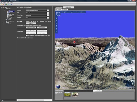
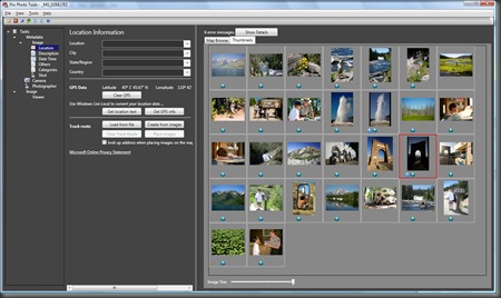
The latest version of Microsoft Pro Photo Tools has been released with some newly added features and improvements in performance. Microsoft Pro Photo Tools provides a set of tools for photographers allowing them to perform various tasks with their images—including RAW captures. The current version enables you to quickly geotag your photos, edit metadata, and organize your images by leveraging the power of Microsoft Live Local.
New features include:
- Support for reading & writing XMP side car metadata enabling interoperability with Adobe products.
- Viewing actual RAW images, in addition to thumbnails
- Conversion of RAW files to JPEG and TIFF using “As Shot” camera settings.
- The ability to resize RAW images.
- Support for 64-bit Windows
- Support for geotagging international locales
- Improved functionality for geotagging images.
It’s even easier now to add GPS information to your photos:
As geotagging gains popularity, photographers want to quickly identify the location for their images. With Pro Photo Tools, you can gather location information from a variety of sources and apply it to the metadata in your images.
- Drag your photos from a folder onto the main viewing window.
- To load recorded GPS data, in the Track Route section, click the Load from File button .
- Select all images by pressing Ctrl+A
- Click the Place Images button under Track Route and the images will be placed on the map.
- When the images are in the correct position along the track route, go to File –> Save All Images with New Data, and the GPS coordinates will be added to your photos based on the time stamps in the track route file.
Pro Photo Tools 2.0 still offers the same features as earlier versions including:
- Determine location name automatically
- Determine GPS coordinates from location name
- Identify location on a map
- View images on Windows Live Maps
- Use Microsoft Virtual Earth for a 3D view of the image location.
- Edit image metadata
- RAW support
For a link to the free download and more information, read the Microsoft Pro Photo Tools article on the Microsoft Pro Photo website.

