My Example Popfly App
Now Popfly is in public beta and the Inspiration Tour is in full swing I thought it'd be a perfect time to knock up a sample application which plots photos taken on the tour onto a Virtual Earth map.
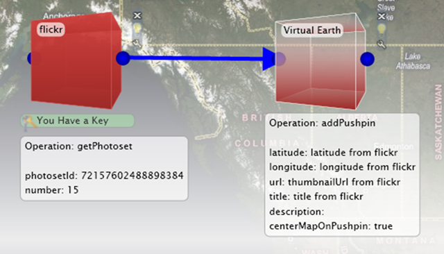
I have hosted the photos on Flickr as a set with each photo tagged with the name of the university where it was taken and geotagged with the longitude and latitude of that university. Using the 'getPhotoset' operation of the Flickr block I retrieved the entire set from Flickr and then using the 'addPushpin' operation of the Virtual Earth block I plotted these photos on a map of the world. By setting the 'centreMapOnPushpin' option to true I ensured that the map would initially be centred on the area where the photos were taken (ie the UK). I also tweaked the 'defaultZoomLevel' to display the UK at a sensible size.
The finished product took about 20mins to complete and can be seen below:
Being a dynamic application it will automatically update as I add new photos to the Inspiration Tour Set on Flickr.
I have shared this app on Popfly so you can take a look at it for yourself (my username is edunhill). Feel free to post links to your interesting Popfly apps in the comments section.
Incidentally you can see photos from our most recent tour date at The University of Bradford on the map, thanks to all of you who came to see us on Wednesday and made us so welcome.
Technorati Tags: Popfly,Inspiration Tour,Microsoft Research,Students,Flickr,Virtual Earth